 |
 |
|
|
|
|
#805
Mount Pleasant Cemetery Richmond Township |
||
Ray County Cemeteries - Web Page
|
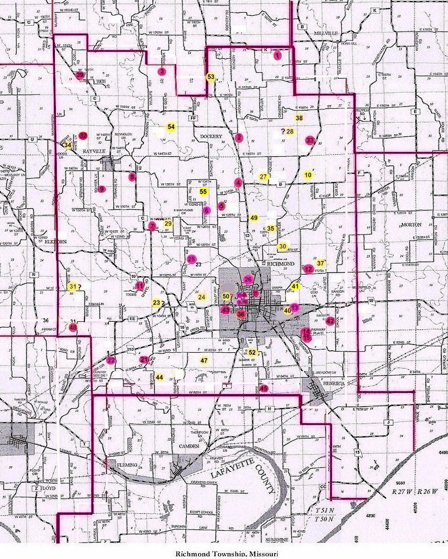
#5 on RichmondTownship Map |
 |
||
| Mount Pleasant Cemetery
(aka Old Cumberland Presbyterian Church Cemetery) (aka Patton Cemetery) |
#5 on RichmondTownship Map |
Latitude: 39°19'32.00"N
Longitude: T52R28S12 |
Ray County Library (big black cemetery binder): Old Cumberland Presbyterian Church is now gone, only the cemetery remains. Cemetery is well kept.
Located 4 miles northwest of Richmond on the east side of Ray County Lake road. From 13 Highway north of Richmond turn west onto W. 128th Street. Drive about 1-1/4 miles. Turn north onto Garner Road. Drive about 3/10 miles. Cemetery is just north of a house (address on mailbox is 12927) on the east side of the road. DAR Index: T52R28S12; SW1/4 This cemetery may possibly have been known as Patton Cemetery: Patton's owned the land around the cemetery in earlier years (T52R28S12) The following death certificates indicate these people were buried in Patton Cemetery. They were actually listed on the Mount Pleasant Cemetery transcription: |
. | Ray REF 929.3 RAY |
 |
 |
 |
 |
Transcription:
Ray County Home Page | MoGenWeb | USGenWeb | WorldGenWeb | E-Mail County Coordinator
To add additional information relating to Ray County, Missouri Genealogy, E-Mail the county coordinator.
since November 11, 2006
Last Updated
