|
#808
Crowley Cemetery Richmond Township |
||
Ray County Cemeteries - Web Page
|
#8 on RichmondTownship Map |
 |
||
| Crowley Cemetery |
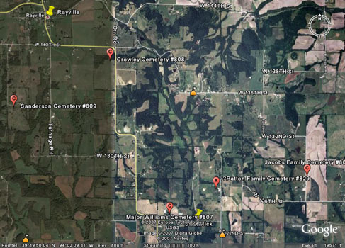
Southeast of Rayville |
Latitude: 39°20'28.00"N
Longitude: |
On October 1, 1884, Newton Parker and Susan, his wife, deeded one and one-fourth acres of land for the sum of one dollar to James Crowley, John Turnage, and William Akers, trustees, for a free burial ground to be known as Jeremiah Crowley Cemetery.
On September 11, 1911, Newton B. Clark, and wife Susan deeded an additional two and three-fourth acres to James M. Francis, Frank B. Clark, and Henry Crowley, trustees. This area was to be laid off in plots and a fee charged for each lot. Deed book 124, page 540 records the following statement - the coal underlying the above described premises together with the rights to mine and remove the same is hereby reserved, but is expressly understood that the surface of said tract of ground is not to be touched or disturbed in the removal of coal. Today [1973] the cemetery is maintained by a trust fund and donations. President, Oren Turnage - board members are: Edgar McGaugh, Dean Swafford, irvin Turnage, Arla Hankins, Virgil Hendrix and Billie Parker. The cemetery is located east and south of Rayville on Route C and is well kept. Source: 1973 Ray County History |
Three Ray County, Missouri cemeteries. by Pauline E. Brown, and Carol Colleen Crowley Brown. Richmond, MO : Pauline Brown, c1973 (Crowley, New Hope, and Rowland Cemeteries)
compiled by Bob Hendricks; list of 177 names on monuments west of the road in the older part of the cemetery. |
Ray REF 929.3 RAY
Ray REF 929 BRO Ray REF 929.2Cro |

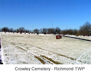
photo submitted by Jennifer Zunker |
||
Transcription:
Ray County Home Page | MoGenWeb | USGenWeb | WorldGenWeb | E-Mail County Coordinator
To add additional information relating to Ray County, Missouri Genealogy, E-Mail the county coordinator.
since November 11, 2006
Last Updated