 |
 |
|
|
|
Geographic Encyclopedia -placesnamed.com
A Directory of Towns, Villages, and Hamlets of Ray County, Missouri, Compiled by Arthur Paul Moser
| A | B | C | D | E | F | G | H | I | J | K | L | M |
| N | O | P | Q | R | S | T | U | V | W | X | Y | Z |
| City or Township | Type | 1895 Population | 1895 Post Office | 1895 Railroad | 1895 Express Office | Latitude | Longitude | USGS 7.5' Map | source |
| A | Top | ||||||||
| Ada |
see Albany
|
||||||||
| Albany |
populated place
|
. | . | . | Loc: 51: 29: 13, 30 Source: 1877 Atlas Property Owners | 391324N | 0940647W | Camden | USGS |
|
Ely Carter established the village of Albany in 1854. He made application for a post-office. But Albany was already in use in Gentry County. Ada, the name of Ely Carter's wife was proposed and accepted, but the village retained the name of Albany. Mr. Carter was the first postmaster. Also called Ashton, originally. It was located one mile northeast of Orrick. It had seven business houses, one school, one flour mill, and one church. Once Orrick grew along the railroad and the Albany stores and churches gradually moved a mile south to the new town. Albany was incorporated in 1871. Daniel Turner served as first mayor |
OT | ||||||||
| Alfred |
Known as Alfred or Floyd. In 1882 near Orrick, the town of Alfred later called Floyd was surveyed, platted and incorporated at the request of the Chicago, Santa Fe, and California Railway companies.
|
OT | |||||||
| Allens Brick Mill |
locale
|
. | . | . | . | -- | -- | -- | USGS |
| Allen's Landing | Riverboat landing |
just east of the Clay/Ray County line
|
1894 MO River Map | ||||||
| Allen's Mill |
Known as Allen's Mill, Lisbonville, and Chicken Bristle. This was located about two miles northeast of present day Elmira on the Ray-Caldwell line and started as Allen's Mill, when Isom Allen and a brother in 1866 installed a stream-powered sawmill, and equipped it with grist milling facilities.
|
OT | |||||||
| Ashton |
original name of Albany
|
p. 454 Ray County History 1881
|
|||||||
| B | Top | ||||||||
| Barton's Landing |
River boat landing
|
1894 MO River Map | |||||||
| Bluffton |
populated place
|
In 1871, according to Louise Darneal, Ray County settlers, fearing an attack by the Indians, built a fort on the Missouri River near where Camden now stands and called it Bluffton. It was the first village founded in Missouri north of the Missouri River and became the first county seat. The first public road in the county ran over 7 miles from Bluffton to John Thornton's mill, east of where Richmond was after founded. Bluffton served as the county seat of Ray until 1828. Twice efforts were made to have it accepted by the county commissioners, but since the title involved many transfers and New Madrid, Missouri, land grants were a part of it, the title never could be cleared sufficiently at that time to be accepted, so the town of Richmond was purchased, platted, and named as the County Seat. Local tradition has it that the first settlers in Bluffton were the members of a Copeland family, at or near Bluffton, who went to Oregon during the land rush thee in 1850's. When Bluffton was started there were no steamboats on the Missouri River, and the river traffic was not considered to be any particular importance. So the fort was built, and the town of Bluffton was started off the river, to the west of what is now Camden, in Sections 26 and 27, Township 51, Range 28. Bluffton's demise began with the regular advent of the steamboat on the Missouri River finished the town, which was already dwindling with the transfer of the county seat to Richmond. Camden, a good steamboat landing site, was platted in 1836, and Bluffton was replaced and gone. |
USGS; OT
photos |
||||||
| Bluffton | township in 1827 | p. 229 Ray County History 1881 | |||||||
| Brownsburgh |
populated place
|
It was platted by John and Matilda Brown in January, 1874 on 33 acres (NE 10, 54-26) near Tinney's Point. |
USGS | ||||||
| Bucksnort |
see Millville
|
Moser |
|||||||
| Buffalo |
populated place
|
The John Vanderpool family came from Tennessee and established the settlement of Buffalo in August 1815 southwest of Hardin on the Crooked River. | . | . | . | -- | -- | -- | USGS
Moser |
| Buffalo City |
It was located out of Hardin southeast about ¾ mile. There was a grocery store, a saloon, and a blacksmith shop near Buffalo. There were no bridges across Crooked River. When the town of Hardin was platted, around 1868, most people promptly moved there, and Buffalo City decayed. |
OT | |||||||
| Buncombe |
Knoxville was laid out in 1837 by John Graves from Tennessee. It was established as Buncombe on January 24, 1838, and the name was changed to Knoxville, (for Knoxville, Tennessee) on October 26, 1838.
|
Moser
|
|||||||
| C | Top | ||||||||
| Camden | Town/City | 650 | Yes | Yes | Yes | 1895 Atlas | |||
| Camden |
populated place
|
. | . | . | . | 391150N | 0940122W | Camden | USGS |
| Camden Junction |
populated place
|
. | . | . | . | 391130N | 0940219W | Camden | USGS |
| Camden, Township of |
township
|
. | . | . | . | 391127N | 0940141W | Camden | USGS |
| Carpenters Mill |
locale
|
. | . | . | . | -- | -- | -- | USGS |
| Cato |
populated place
|
This is another short-lived attempt at a community which started in August 1892 and only survived until September 1893. |
USGS; OT | ||||||
| Chicken Bristle |
Known as Allen's Mill, Lisbonville, and Chicken Bristle. This was located about two miles northeast of present day Elmira on the Ray-Caldwell line and started as Allen's Mill, when Isom Allen and a brother in 1866 installed a stream-powered sawmill, and equipped it with grist milling facilities.
|
OT
|
|||||||
| Cooleys Lake | Town/City | No | Yes | No | . | . | . |
1895 Atlas
|
|
| Cooper's Landing |
River boat landing
|
1894 MO River Map | |||||||
| Crab Orchard |
Town/City
Elk Horn |
p. 455 Ray County History 1881 | Yes | No | No | Loc: 52: 29: 13, 29 Source: 1877 Atlas Property Owners | . | . | 1895 Atlas |
| Crooked River, Township of |
township
|
p. 241 Ray County History 1881 | . | . | . | 391636N | 0934955W | Hardin | USGS |
| Crystal Lakes |
populated place
|
. | . | . | . | 392134N | 0941123W | Excelsior Springs | USGS |
| D | Top | ||||||||
| Danner's Landing |
River boat landing
|
1894 MO River Map
|
|||||||
| Dockery |
populated place
|
. |
Yes
|
No | No | 392140N | 0935918W | Richmond |
1895 Atlas; USGS
OT |
| E | Top | ||||||||
| East Camden |
see Camden
|
||||||||
| Egypt Bottom |
bend
One of the first settlers in Egypt was Joseph Ray, a French trapper According to the late Mrs. Thurman (Julia) Dudgeon, Egypt acquired its name in 1895 following a flood after Mr. Ray had taken his belongings to the site of South Point by raft for safety. When the waters receded and Mr. Ray was asked what he was going to do he said that he was "going back to Egypt," thus comparing the fertility of the soil to that of the Delta of the Nile in ancient Egypt ... (--Ray County, p. 90.) |
. | . | 391152N | 0940938W | Buckner | USGS
Moser |
||
| Elderton |
Located on the road east and a little north of Morton about three miles. I can not find any evidence of the town ever having come into any further existence than just the platting. |
USGS; OT | |||||||
| Elkhorn |
populated place
|
. | . | . | Loc: 52: 29: 13, 29 Source: 1877 Atlas Property Owners | 391833N | 0940645W | Rayville | USGS |
| Elmira |
populated place /Town/City
|
75 | . | Yes | Yes | 393026N | 0940916W | Elmira | USGS; 1895 Atlas |
| Elmira Camp |
populated place
|
. | . | . | . | 392947N | 0940927W | Lawson | USGS |
| Excelsior Springs |
City
|
. | Located both in Ray County and Clay County | Excelsior Springs Historical Museum: Research Available | |||||
| F | Top | ||||||||
| Fair View |
Also known as Pleasant View and Slip Up. The village was situated on a tract of high, rolling prairie land, laid out about the year 1857 by a German named Isaac Berry. The location was in the west part of Section 27, Township 54, Range 29. Between Crooked River's flooding and the coming of the railroad this little village gradually faded away, only the cemetery remaining today.
|
OT | |||||||
| Farmville |
populated place
see Henrietta |
-- | -- | -- | USGS | ||||
| Finley's Landing |
Riverboad landing
|
1894 MO River Map | |||||||
| Fishing River, Township of |
township
|
p. 241-242 Ray County History 1881 | 391704N | 0940957W | Excelsior Springs | USGS | |||
| Fleming |
populated place
|
391157N | 0940355W | Camden | USGS | ||||
| Fleming |
Town/City
|
Yes
|
No | No | 1895 Atlas | ||||
| Floyd |
populated place
|
No
|
Yes | No | 391133N |
0940638W
|
Camden
|
USGS; 1895 Atlas | |
|
Known as Alfred or Floyd. In 1882 near Orrick, the town of Alfred later called Floyd was surveyed, platted and incorporated at the request of the Chicago, Santa Fe, and California Railway companies.
|
OT | ||||||||
| Foote Station |
see Rayville
|
Moser
|
|||||||
| Fox |
Town/City
|
. |
Yes
|
No | No | Loc: 53: 26: 16, 8 Source: 1877 Atlas Property Owners | . | . |
1895 Atlas
|
|
Known as Russellville or Fox. Russellville was founded about 1853, 5 miles East of Millville. It was in the 1900's that it became necessary to change the name of the post office to Fox to avoid confusion with the mail with another Russellville, Missouri
|
OT | ||||||||
| Foxglove Conservation Area |
Location: (T53N, R29W, S23 and S24) Ray County. Approximately 5 miles northeast of Excelsior Springs. One-half mile east of Vibbard on gravel road 174 and .5 mile north on gravel road 235. Origin of name: Named after the auriculate false foxglove (Agalinus auriculata), which is common on the area. Size: 55 acres (35 prairie, 20 being restored). Ownership: Missouri Department of Conservation, 1990. Features: This rolling, brushy prairie formed predominately on silty clay loam and clay loam soils. The area has good plant diversity including lead plant, rattlesnake master and compass plant. Small populations of hairy parsley and prickly pear cactus are associated with small limestone outcrops on the area. Periodic prescribed fires are used to help reduce invasion of woody species and to stimulate the native prairie grasses and forbs.
|
||||||||
| Fredonia |
locale
|
This town was platted in September 1869 just after the Civil War by Emilius Wood. It was to be located between Richmond and Henrietta, in the northeast quarter of Section 9, Township 51, Range 27 West. |
USGS; OT | ||||||
| Fredericksburg |
Was located east-northeast of the present day Excelsior Springs Golf Course. One of the five battles, or skirmishes, of the Civil War in Ray County occurred here. In 1842, the post office was re-established and known as New Garden. |
OT | |||||||
| Fredricksburg |
populated place
|
. | . | . | Loc: 52: 29: 8, 29 Source: 1877 Atlas Property Owners | -- | -- | USGS | |
| Frog Eye |
populated place
|
Known as Mineral City or Frog Eye. In the summer of 1903, just around the bend of Crooked River and Fire Creek, Stephen Mullin and some of his neighbors decided to drill a well on his land because there had been a severe water shortage, and Fire Creek was insufficient to supply everyone's needs in the emergency. The water from the well proved to be a strong soda-saline type similar to that of the defunct St. Cloud, and this revived hopes again of prosperity from the health giving water. Through the years following, Mullin's well became famous. In 1908, according to the records at the courthouse, Stephen M. and Louisa Mullin and Peter J. Carchas of St. Joseph, a lawyer whom Mullin had consulted about legal matters, filed a plat of the proposed Mineral City. The water became so famous it was shipped in barrels to other states. Finally, at the death of Mullin, debts were so out standing that his family moved away, the well was capped, and the well house torn down, and today a few bits of foundations here and there are all that remain of this bit of Ray County history. | OT | ||||||
| G | Top | ||||||||
| Georgeville |
populated place
Georgeville was founded in the 1880's. It was first named Grange Hall, for the first structure built at the site a "Grange Hall." About three miles north of the present site a settlement was established called Georgeville in honor of the George family on whose land it was built. |
Loc: 54: 27: 15, 14 Source: 1877 Atlas Property Owners | 392946N | 0935429W | Millville | USGS
Moser |
|||
|
Town/City
|
Yes
|
No | No |
1895 Atlas
|
|||||
| Golf Hill (subdivision) |
populated place
|
392004N | 0941233W | Excelsior Springs | USGS | ||||
| Grange Hall |
see Georgeville
|
||||||||
| Grape Grove |
This was mentioned several times in early family stories, but only that it was at a cross-roads. Grape Grove established a post office May 29, 1838. Grape Grove's name was changed to Millville June 27, 1847. |
USGS; OT | |||||||
| Grape Grove, Township of |
township
|
p. 243 Ray County History 1881 | 392555N | 0935109W | Stet | USGS | |||
| Griffith's Landing |
River boat landing
|
1894 MO River Map | |||||||
| H | Top | ||||||||
| Hallard |
Town/City
|
No
|
Yes | Yes |
1895 Atlas
|
||||
| Haller |
populated place
|
. | . | . | . | Loc: 52: 28: 5, 20 Source: 1877 Atlas Property Owners | . | . | 1877 Atlas |
| Haller Station |
Rayville Post Office
|
p. 454 Ray County History 1881
|
|||||||
| Halleville |
Known as Halleville and Oil City. It came into being north of Orrick about 1898 - 1900, when a sixteen-hundred foot oil well was drilled there. It proved to be a dry hole.
|
OT | |||||||
| Hallsville |
populated place
|
-- | -- | -- | USGS | ||||
| Hamilton Heights |
locale
|
north of Henrietta | T51R27S09 | -- | -- | USGS | |||
| Hardin |
Town/City
|
656 | Yes | Yes | Yes | The John Vanderpool family came from Tennessee and established the settlement of Buffalo in August 1815 southwest of Hardin on the Crooked River.
Hardin was named for Governor C. H. Hardin, and incorporated in 1870. James Darby was the first mayor. |
. | . |
1895 Atlas
Moser |
| Hardin |
populated place
|
. | . | . | . | 391615N | 0935003W | Hardin | USGS |
| Henrietta |
populated place
|
In the 1830's James Allen and his brother, Dr. Thomas Allen, from Farmville, Virginia established the settlement known as Farmville.
In the 1900's Joseph Black, a city attorney of Henry, had learned that Henrietta post-office had been abandoned and in 1925 he induced the railroad and post-office to change the name to Henrietta. |
391403N | 0935607W | Lexington West | USGS
Moser |
|||
| Henry |
Town/City
post office |
. | Yes | No | No | Loc: 51: 27: 16, 15 Source: 1877 Atlas Property Owners | . | . | 1895 Atlas |
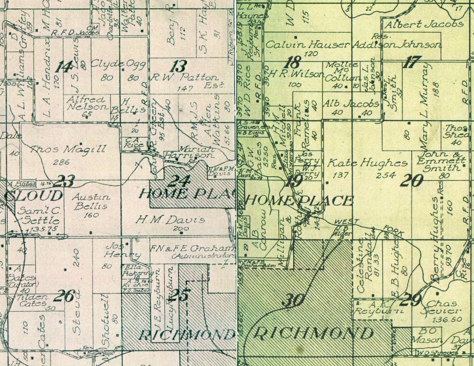
| Home Place |
T52R28S24 & T52R27S19
1914 Standard Atlas of Ray County |
Home Place Links | |||||||
| Homestead |
populated place
|
. | . | . | . | 392146N | 0941202W | Excelsior Springs | USGS |
| Hughes Landing
(Hughs Landing) |
locale
River boat landing |
. | . | . | . | -- | -- | -- | USGS
1894 MO River Map |
| Hulls Point |
populated place
|
p. 455 Ray County History 1881 |
No
|
Yes |
No
|
-- | -- | -- | USGS; 1895 Atlas |
|
According to the 1877 Ray County Atlas, about five miles west-northwest of Orrick. |
OT | ||||||||
|
Riverboat landing
|
1894 MO River Map
|
||||||||
| J | Top | ||||||||
| Jack's Ferry |
locale
|
see Henrietta | . | . | . | -- | -- | -- | USGS |
| K | Top | |||||||||
| Knoxville |
populated place
|
81 |
Yes
|
No | No | Loc: 54: 28: 35, 26 Source: 1877 Atlas Property Owners | 392646N | 0940100W | Knoxville | USGS; 1895 Atlas |
|
Knoxville was laid out in 1837 by John Graves from Tennessee. It was established as Buncombe on January 24, 1838, and the name was changed to Knoxville, (for Knoxville, Tennessee) on October 26, 1838.
The first postmaster of Knoxville was Moses F. Rainwater who was appointed January 24, 1838. |
Moser | |||||||||
| Knoxville, Township of |
township
|
. | . | . | . |
392648N
|
0940034W | Knoxville | USGS | |
| L | Top | |||||||||
| Lakeview |
populated place
|
. | . | . | . | 391921N | 0934636W | Hardin | USGS | |
|
For over seventy years from 1880's to 1952 when the last mine closed this mining village, located about 3 ½ mile northeast of Hardin, was very active. Heisinger Lake, which once lay to the southeast of the town, was the source of the name. Coal which so richly underlies most of Ray County was the source of employment foremost of the people in the village, as it was in many other Ray County towns of that period. The last store closed in 1948, and when the remaining mine stopped when the demand for coal declined due to natural gas and electricity coming into easy supply, Lakeview's reason for existing was gone and so was the town. |
OT | |||||||||
| Lawson |
populated place
|
520 | Yes | Yes | Yes |
Loc: 53: 29: 6, 28 Source: 1877 Atlas Property Owners
|
392618N | 0941214W | Lawson | USGS
1895 Atlas |
| Lexington Junction |
Town/City
|
No
|
Yes | Yes | . | . | . |
1895 Atlas
|
||
| Lick Skillet |
populated place
|
Known as Taitsville and Lick Skillet. It was in 1833 that a settlement was first made here. It's demise was helped along by the coming of the railroad in 1887. |
OT | |||||||
| Lisbonville |
populated place
|
Known as Allen's Mill, Lisbonville, and Chicken Bristle. This was located about two miles northeast of present day Elmira on the Ray-Caldwell line and started as Allen's Mill, when Isom Allen and a brother in 1866 installed a stream-powered sawmill, and equipped it with grist milling facilities. | USGS; OT | |||||||
| Log Cabin Station |
locale
|
392525N | 0934852W | Stet | USGS | |||||
| Louella |
town/city; post office
|
Yes
|
No | No |
1895 Atlas; USGS; OT
|
|||||
|
In May 1900, a post office was established giving its location in the SE ¼, Section 32 Township 54 North, Range 26 West or roughly in the center of a triangle formed by Fox, Regal and Ovid. |
USGS | |||||||||
| Lower Town |
see Camden
|
Moser | ||||||||
| M | Top | |||||||||
| McBee's Landing |
In 1836 a caravan of ox teams with the recently widowed Mrs. Rachel (Riley) McBee and her 4 married sons stopped and settled just east of Hardin where the Red Brick School was later located. But floods, very severe that year, forced them to uproot themselves and move on up into the bluff country in 1837 and they finally settled in the area past Millville where New Hope M.E. church is today. |
OT | ||||||||
| McClain's Mill |
By 1935 there were enough settlers in the northwest part of present day Ray County to require a log schoolhouse. The "Battle of Crooked River" a day's skirmish between Mormons of adjoining Caldwell County and a militia of Ray County, took place in 1838, in a valley one mile south of that school. Upstream a short distance from where the battle took place, a Mr. McClain began operating a water-powered grist mill near the Ed Knutter ford over Crooked River; this being only a short distance southeast of present-day Elmira. The post office there was established in 1858 and ran until 1860, but then the name was changed to Pleasant View. |
OT | ||||||||
| Millville |
populated place
|
175 |
Yes
|
No
|
No
|
Loc: 53: 27: 15, 27 Source: 1877 Atlas Property Owners
|
392419N | 0935504W | Millville | USGS; 1895 Atlas |
|
Originally called Bucksnort, the name was changed to Millville in 1865. It has also been referred to as "The Wee Village". The last grocery store closed in 1971. Located Route K about 11 miles northeast of Richmond on the east fork of Crooked River. |
OT
Moser |
|||||||||
| Mineral City |
locale
|
Known as Mineral City or Frog Eye. In the summer of 1903, just around the bend of Crooked River and Fire Creek, Stephen Mullin and some of his neighbors decided to drill a well on his land because there had been a severe water shortage, and Fire Creek was insufficient to supply everyone's needs in the emergency. The water from the well proved to be a strong soda-saline type similar to that of the defunct St. Cloud, and this revived hopes again of prosperity from the health giving water. Through the years following, Mullin's well became famous. In 1908, according to the records at the courthouse, Stephen M. and Louisa Mullin and Peter J. Carchas of St. Joseph, a lawyer whom Mullin had consulted about legal matters, filed a plat of the proposed Mineral City. The water became so famous it was shipped in barrels to other states. Finally, at the death of Mullin, debts were so out standing that his family moved away, the well was capped, and the well house torn down, and today a few bits of foundations here and there are all that remain of this bit of Ray County history. |
USGS; OT | |||||||
| Mineral Oil Spring | Moser | |||||||||
| Missouriton |
township in 1827
|
p. 229 Ray County History 1881 | ||||||||
| Morton | populated place | . | Yes | No | No |
Loc: 52: 26: 18, 23 Source: 1877 Atlas Property Owners
|
391910N | 0935138W | Hardin | USGS; 1895 Atlas |
| Mt. Pleasant |
populated place
|
98 | . | . | . | Loc: 54: 26: 10, 9 Source: 1877 Atlas Property Owners | . | . | . | 1877 Atlas |
| N | Top | ||||||||
| New Garden |
populated place
post office |
p. 455 Ray County History 1881 | . | . |
Loc: 52: 29: 8, 29 Source: 1877 Atlas Property Owners
|
391923N | 0940957W | Excelsior Springs | USGS |
|
This location is near the western border of Ray County, about 4 miles east and a little south of Excelsior Springs. In this area in 1842 the New Garden Primitive Baptist Church was organized with 15 members, all with letters from Big Pigeon Baptist Church, Cocke County, Tennessee. There is a legend to account for the fact that for many years it was known as the Church of the Lost Child. |
OT | ||||||||
| North Bluffton | locale | . | . | . | . | -- | -- | -- | USGS |
| North Lexington |
Town/City
left bank of Missouri River, opposite Lexington |
p. 455 Ray County History 1881 | No | Yes | No | . | . | . | 1895 Atlas |
| O | Top | |||||||||
| Oak Grove Community | south of Hardin | |||||||||
| Oggs Mill | locale | . | . | . | 391750N | 0940509W | Rayville | USGS | ||
| Oil City |
Known as Halleville and Oil City. It came into being north of Orrick about 1898 - 1900, when a sixteen-hundred foot oil well was drilled there. It proved to be a dry hole.
|
OT | ||||||||
| Old Foot |
Sometimes called Foote Station, as a post office it is said to have been near or at the residence of William H. McGaugh. When a railroad was built from North Lexington to St. Joseph, the post office at Otsego was moved to Old Foot Station (this was evidently just before Haller, now Rayville, was platted in 1871). |
OT | ||||||||
| Orrick |
populated place
|
370 |
Yes
|
Yes | Yes |
Loc: 51: 29: 23, 30 Source: 1877 Atlas Property Owners
|
391246N | 0940721W | Camden | USGS; 1895 Atlas |
| Orrick, Township of |
township
|
. | . | . | . | 391400N | 0940918W | Buckner | USGS | |
| Orton |
During the years 1899 and 1900 there was a post office. It's location is in the area between Orrick and Elkhorn somewhere. |
OT | ||||||||
| Otsego |
Jason N. Baker was the first postmaster beginning May, 1851. This location was, according to information from the National Archives, seven miles west of Knoxville, and one mile north of Rocky Ford Creek. James F. Blackwell was the last listed postmaster, the office being discontinued in 1871, giving way to the location of Old Foot along the newly built railroad line. |
OT | ||||||||
| Ovid |
Town/City
|
. |
Yes
|
No
|
No | . | . | . |
1895 Atlas
|
|
|
populated place
|
. |
.
|
. |
.
|
392803N | 0935302W | Millville | USGS | ||
|
About 5 miles northeast of Millville was this little settlement. There was not school, and the nearest church was West Antioch Church. |
OT | |||||||||
| P | Top | ||||||||
| Petersburg |
Located a short way north of the Crooked River bridge which is on Highway 10 just before you reach Hardin. |
OT | |||||||
| Piggsville |
populated place
|
. | . | . | . | -- | -- | -- | USGS |
| Pleasant View |
populated place
|
Also known as Fair View and Slip Up. The village was situated on a tract of high, rolling prairie land, laid out about the year 1857 by a German named Isaac Berry. The location was in the west part of Section 27, Township 54, Range 29. Between Crooked River's flooding and the coming of the railroad this little village gradually faded away, only the cemetery remaining today. | USGS; OT | ||||||
| Polk, Township of |
township
|
. | . | . | . | 392849N | 0940556W | Knoxville | USGS |
| Pomeroys Ferry |
locale
|
. | . | . | . | -- | -- | -- | USGS |
| Prospect Hill |
post office
|
. | . | . | . |
Located south of present day Lawson on the Plattsburg-Richmond Road
|
-- | USGS | |
| R | Top | |||||||||
| R & L Junction |
see Henrietta
|
Moser
|
||||||||
| Rayville |
Town/City
|
91 | Yes | Yes | Yes | Loc: 52: 28: 5, 20 Source: 1877 Atlas Property Owners | . | Haller | 1895 Atlas | |
| Rayville |
populated place
|
. | . | . | . |
392054N
|
0940346W
|
Rayville | USGS | |
| Reavis Landing | River boat landing | 1894 MO River Map | ||||||||
| Regal |
populated place
|
. | . | . | . |
392803N
|
0934852W
|
Stet | USGS | |
| Richmond (county seat) |
Town/City
|
2895 (1895)
23,708 (2000) |
Yes
|
Yes | Yes |
Loc: 52: 28: 25, 36, 20 Source: 1877 Atlas Property Owners
|
391643N
|
0935836W |
Richmond
|
USGS; 1895 Atlas
|
| Richmond Water Works |
locale
|
. | . | . |
391422N
|
0935806W
|
Lexington West | USGS | ||
| Richmond, Township of | township | p. 242 Ray County History 1881 | . | . | . | 391715N |
0935854W
|
Richmond | USGS | |
| Rockingham |
Populated Place
|
. |
Yes
|
No | No |
392124N
|
0934656W |
Hardin
|
USGS; 1895 Atlas | |
|
This agricultural community northeast of Hardin was founded by families from the Shenandoah Valley, Rockingham County, Virginia, following the ravaging of Sheridan's men during the Civil War. These early settlers were of deep religious convictions and were members of the Church of the Brethren. |
OT | |||||||||
| Russellville | populated place |
Loc: 53: 26: 16, 8 Source: 1877 Atlas Property Owners
|
392424N | 0934948W | Stet | USGS | ||||
|
Known as Russellville or Fox. Russellville was founded about 1853, 5 miles East of Millville. It was in the 1900's that it became necessary to change the name of the post office to Fox to avoid confusion with the mail with another Russellville, Missouri
|
OT | |||||||||
| S | Top | ||||||||
| Saint Cloud | populated place | 391734N | 0940105W | Rayville | USGS | ||||
| Saint Cloud |
In 1880 a mineral spring was found bubbling up through the earth on a farm 4 miles northwest of Richmond. It was called St. Cloud Springs and a company was formed to develop the area. The Maple Leaf Hotel, a two story building, was erected near the spring, and the complex grew to include a butcher shop, a saloon, a bathhouse where the ailing took mineral and mud baths, and even summer cottages. Four passenger trains per day came to the area bringing tourists, so a depot was added. Cave Spring was not far from here, which provided additional recreation for the walk there and back. But problems arose; business became slack, the hotel began to lose money, there were squabbles between the owners of the land, and finally, when the hotel burned in 1890, St. Cloud gradually disappeared, leaving only the little spring. This, too, vanished when the creek changed its course and started flowing directly over the mineral spring, and St. Cloud was a thing of the past. |
OT | |||||||
| Saint Cloud Springs | Town/City | No | Yes | No | 1895 Atlas | ||||
| Sandals |
populated place
by Thomson (Sandals) Cemetery |
Yes
|
No | No | 392738N | 0940501W | Knoxville |
USGS; 1895 Atlas
|
|
|
Known first as the Grange store, then as Sandals Store, it finally was shortened to just Sandals. James Sandals had a grist and saw mill here as well as his store. It was located about 100 feet from the old Plattsburg State Road, but today would be easier placed if I say it was about one mile north and four miles west of Knoxville. |
OT | ||||||||
| Shaw's Shop |
see Morton
|
Moser
|
|||||||
| Sheridan |
see Rayville
|
Moser
|
|||||||
| Sisk |
Town/City
|
Yes
|
No | No |
1895 Atlas
|
||||
|
In September 1883, Bartlett Sisk made an application to change the post office from New Garden a distance of ¾ miles to his house and to call it Sis's Mill. |
OT | ||||||||
| Sisks Mill |
locale
|
-- | -- | -- | USGS | ||||
| Slip Up |
Also known as Pleasant View and Fair View. The village was situated on a tract of high, rolling prairie land, laid out about the year 1857 by a German named Isaac Berry. The location was in the west part of Section 27, Township 54, Range 29. Between Crooked River's flooding and the coming of the railroad this little village gradually faded away, only the cemetery remaining today.
|
OT
|
|||||||
| Snowden's Landing | River boat landing | 1894 MO River Map | |||||||
| Stegler's Landing | River boat landing | 1894 MO River Map | |||||||
| Stet |
populated place
|
. | . | . | . | 392523N | 0934531W | Stet | USGS |
| Sulphur Springs |
Moser
|
||||||||
| Sunshine |
Town/City
|
. |
Yes
|
No | No | . | . | . | 1895 Atlas |
|
Southwest of Henrietta lies an area known as the Sunshine Bottoms. The first school was built around 1840 here, and the first Methodist church of Sunshine was organized in 1848, it being only the second M.E. in Ray County at the time. Occupations in the area besides farming were sawing and rafting logs since this was very near the Missouri River. Tobacco and hemp were among the early crops raised and sold in this area. On July 2, 1915, erratic Missouri River cut a new channel, eliminating the "Great Bend" which had given prominence to Camden and Orrick. A beautiful natural lake was formed in the Bottoms as a result of this and it was called Sunshine Lake for the area where it forme
|
OT
|
||||||||
| Swantick |
Town/City
|
. |
Yes
|
Yes | No | . | . | . | 1895 Atlas |
| Swanwick |
populated place
|
. | . |
Loc: 52: 28: 15, 20 Source: 1877 Atlas Property Owners
|
391851N | 0940151W | Rayville | USGS | |
|
Located 5 miles northwest of Richmond, this was another little village which came into existence in the 1870's because of the railroad. It was name by Major R.J. Williams in honor of a lady in St. Joseph whose first name was Swanie. |
OT | ||||||||
| T | Top | |||||||||
| Taitsville |
populated place
|
90 |
Yes
|
No | No |
Loc: 54: 27: 17, 14 Source: 1877 Atlas Property Owners
|
392904N | 0935728W | Millville |
USGS; 1895 Atlas
|
|
Known as Taitsville and Lick Skillet. It was in 1833 that a settlement was first made here. It's demise was helped along by the coming of the railroad in 1887. |
OT | |||||||||
| Tinney Grove |
populated place
|
. | . | . | . | 393015N | 0934815W | Braymer | USGS | |
| Tinney's Grove |
Town/City
|
77
|
Yes | No | No | Loc: 54: 26: 10, 9 Source: 1877 Atlas Property Owners | . | . | . |
1895 Atlas
|
| Tinney Point |
Moser
|
|||||||||
| Turner's Grove |
p. 268 Ray County History 1881
|
|||||||||
| U | Top | |||||||||
| Union |
Union is situated at Sec. 11, Twp. 53 N, R. 29 W on C east of M.
Mail via Lawson, no population is shown. (--Rand McNally, 1974.) |
Moser
|
||||||||
| V | Top | |||||||||
| Vard Davis Sawmill |
locale
|
-- | -- | -- | USGS | |||||
| Vattie |
From 1892, August, through April, 1895, a post office existed in this area about 21/2 miles south of Elkhorn. |
OT | ||||||||
| Vibbard |
populated place
|
127
|
Yes
|
Yes | Yes |
Loc: 53: 29: 22, 27, 28 Source: 1877 Atlas Property Owners
|
392250N | 0940846W | Lawson | USGS; 1895 Atlas |
| W | Top | |||||||||
| Walconda |
post office
|
A post office existed from August 21, 1856, through February 18, 1859. George S. Ewing was the postmaster of record. The name seems to be another attempt to spell Wakenda Creek. |
USGS | |||||||
| Watkins (historical) |
locale
|
392540N | 0941053W | Lawson | USGS | |||||
| The Wee Village |
see Millville
|
Moser
|
||||||||
| Weislaus Landing | River boat landing | just west of the Ray/Carroll county line | 1894 MO River Map | |||||||
| Westover | Watkins family farm | near Richmond (source records simply read Westover, Ray County, Missouri). This was not actually a town. | ||||||||
| Wilmont |
town in Grape Grove township
|
p. 243 Ray County History 1881 | ||||||||
| Wilmott (Wilmot) |
post office
|
A post office was opened here in 1874 with Charles L. Bowen as official in charge, followed by Alvina Bowen in 1879, then being discontinued in 1887. It's location is 4 miles north of Fox-Russellville, 6 miles south of Tinney's Grove and 4 ½ miles southeast of Ovid. |
Loc: 53: 26: 5, 8 Source: 1877 Atlas Property Owners
|
USGS; OT; 1877 Atlas | ||||||
| Wood Heights |
populated place
|
. |
.
|
. | . | 392022N | 0940945W | Excelsior Springs | USGS | |
| Woolard Place |
seat of Justice in 1827
|
p. 229 Ray County History 1881 | ||||||||
Source:
1895 Atlas: website
USGS: US Geological Survey, National Mapping Information; website
OT: Old Towns. Extracts from an article written by Virginia King McBee "Gone But Not Entirely Forgotten" (Probably written in the 1970's)
A directory of towns, villages, and hamlets past and present of Ray County, Mo. / compiled by Arthur Paul Moser website
1894 Missouri River Commission Maps calibrated by Wayne Johnson; website
Ray County Home Page | MoGenWeb | USGenWeb | WorldGenWeb | E-Mail County Coordinator
To add additional information relating to Ray County, Missouri Genealogy, E-Mail the county coordinator.
since April 1, 2002
Last Updated