|
 |
|
|
|
|
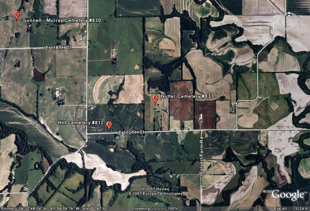
#837
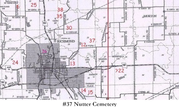
Nutter Cemetery Richmond Township |
||
Ray County Cemeteries - Web Page
|
#37 on RichmondTownship Map |
 |
||
| Nutter Cemetery |
#37 on Richmond Township Map |
Latitude: 39°17'48.00"N
Longitude: |
DAR Index: T52R27S27 [If the USGS GNIS is correct, this should be Section 21 not 27]
1997 Atlas: marked in section 21 2005 Atlas: marked in section 21 |
Genealogy Trails Transcription online |
Transcription:
Ray County Home Page | MoGenWeb | USGenWeb | WorldGenWeb | E-Mail County Coordinator
To add additional information relating to Ray County, Missouri Genealogy, E-Mail the county coordinator.
since November 11, 2006
Last Updated