|
 |
|
|
|
|
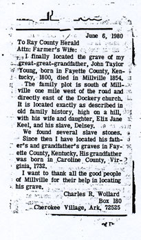
#828
Keel - Young Cemetery Richmond Township |
||
Ray County Cemeteries - Web Page
|
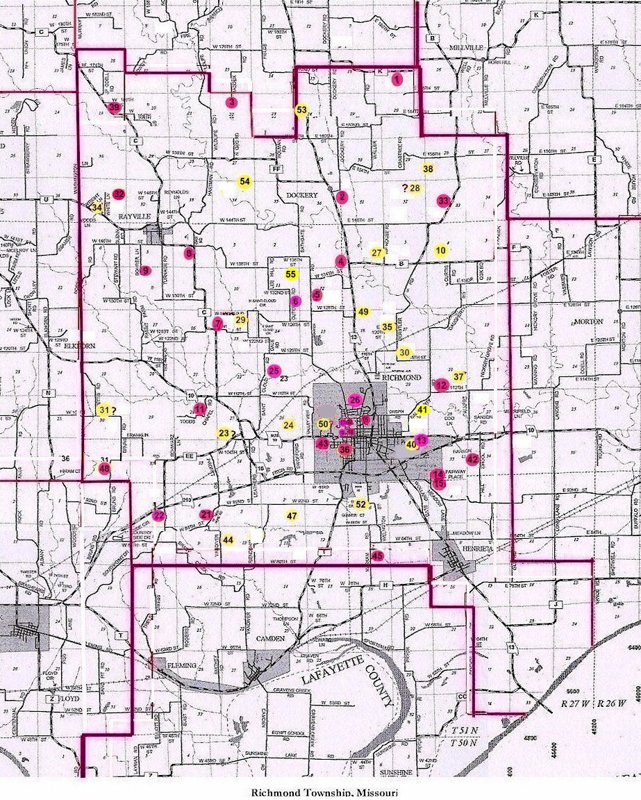
#28 on RichmondTownship Map |
Keel Young Cemetery |
||
| Keel - Young Cemetery | #28 on Richmond Township Map | Latitude: Longitude: |
Ray County History 1973, p. 232 Cemeteries Not Listed on Map, #30: Keel Cemetery, located on what was known as the Hugh Meadow's farm
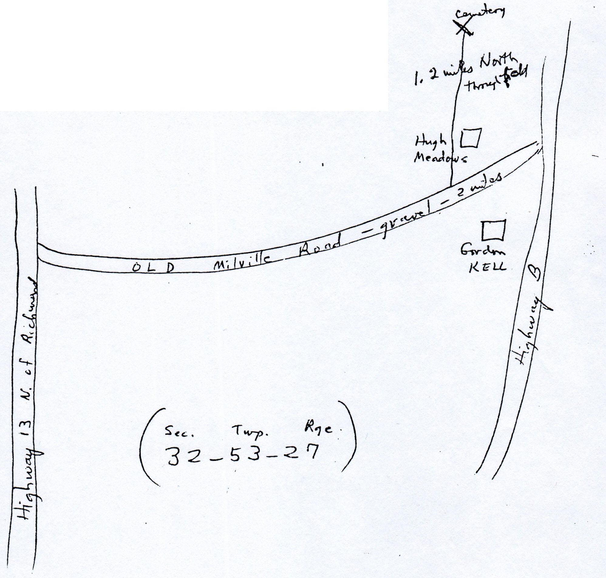
Ray County Museum box #3 Keel Cemetery: located in extreme northeast part of Section 32 on property owned by Dwayne Macey; 2 miles west of Hwy 13 on a gravel road [E. 144th St?]; 1.2 miles north through a field DAR Index: Keel Cemetery T53R27 NE1/4 of SW1/4 of Sec 32 Tree Climber Notes v. 3, p. 28: This Cemetery is located in T53r27S32 |
Recorded in 1974.
Copied by Rilla and Robert Simmons. |
Ray REF 929.3 RAY |
newspaper clipping in Ray County Library big black cemetery binder |
||
Transcription:
Ray County Home Page | MoGenWeb | USGenWeb | WorldGenWeb | E-Mail County Coordinator
To add additional information relating to Ray County, Missouri Genealogy, E-Mail the county coordinator.
since November 11, 2006
Last Updated