|
 |
|
|
|
|
#804
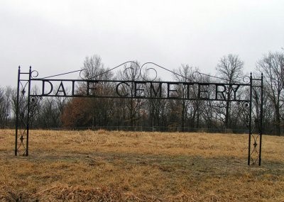
Joshua Dale Cemetery Richmond Township |
||
Ray County Cemeteries - Web Page
|
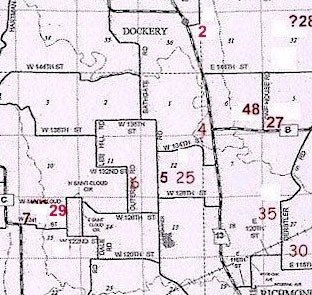
#4 on RichmondTownship Map |
 |
||
| Joshua Dale Cemetery |
#4 on RichmondTownship Map |
Latitude: 39°20'2.00"N Longitude: T52R28S12 |
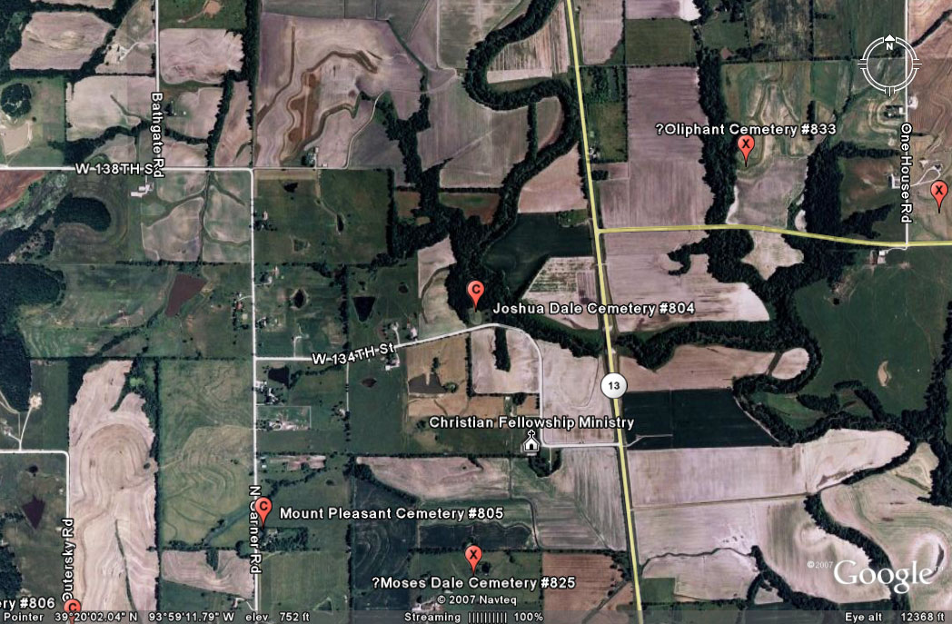
Location 4 on the map, p. 230 of the 1973 History. From Highway 13 north of Richmond, turn west onto W. 134th Street. Drive about 6/10 miles; road will turn north and then curve back west. As the road curves back west, the cemetery is on the right (north) side of the road. Cemetery is well maintained. Located four miles northwest of Richmond, MO on the west side of MO 13 at County Road B. Jennifer Zunker has photographed all the stones she could find in the cemetery Ray County Library (big black cemetery binder): Located 4 miles northwest of Richmond. Three miles north of Richmond on Highway 13, turn on M, west on gravel road 1 mile. Entrance at top of hill, back in the pasture, L. S. Stewart farm. |
Ray REF 929.3 RAY |
||
|
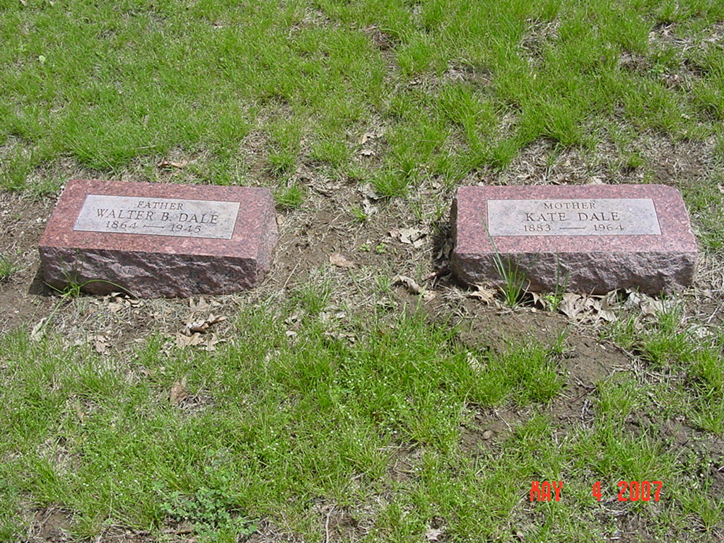
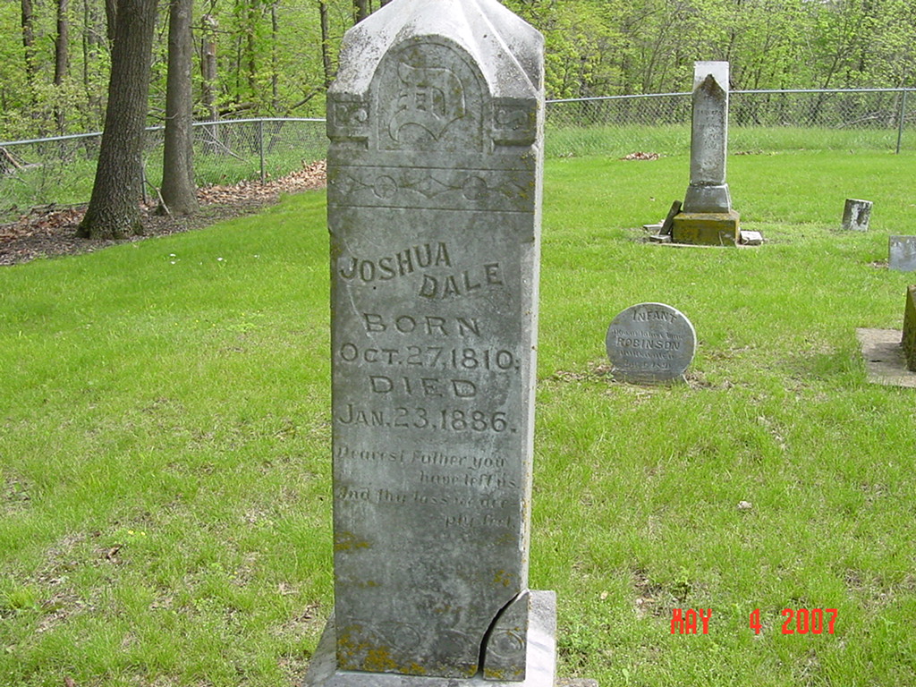
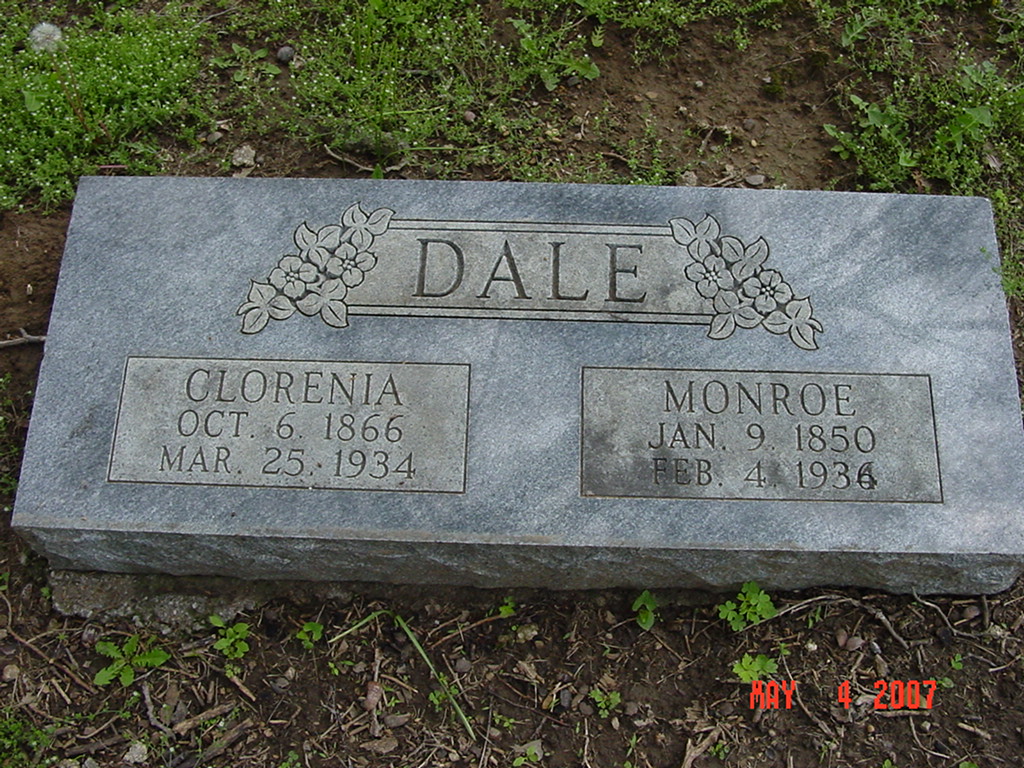
photo submitted by Jennifer Zunker |

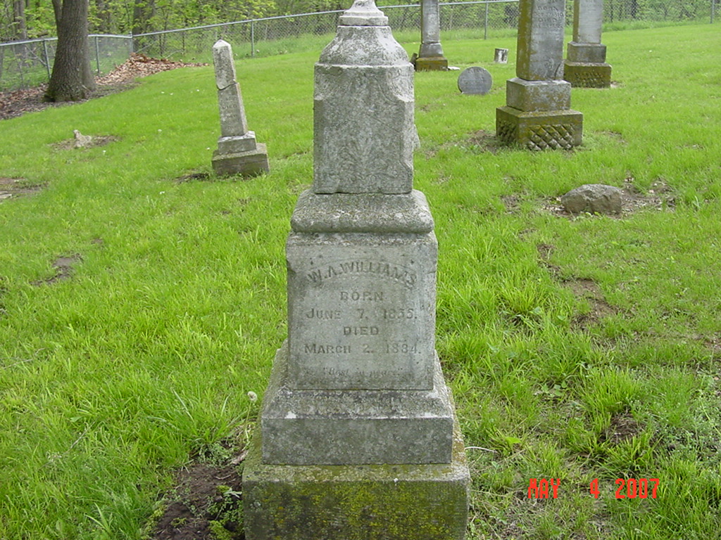
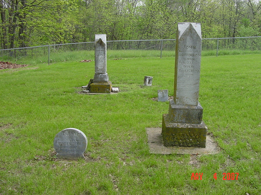
photo submitted by Jennifer Zunker |
 |
 |
 |
 |
 |
 |
 |
Transcription:
Ray County Home Page | MoGenWeb | USGenWeb | WorldGenWeb | E-Mail County Coordinator
To add additional information relating to Ray County, Missouri Genealogy, E-Mail the county coordinator.
since November 11, 2006
Last Updated