 |
 |
|
|
|
|
#822
Thomas A. Brown Cemetery Richmond Township |
||
Ray County Cemeteries - Web Page
|
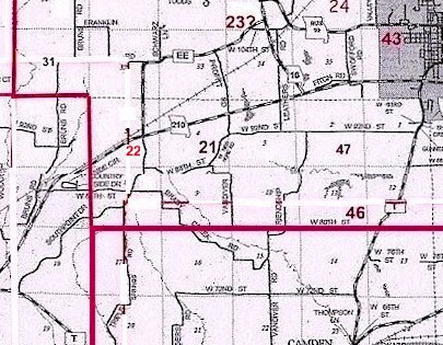
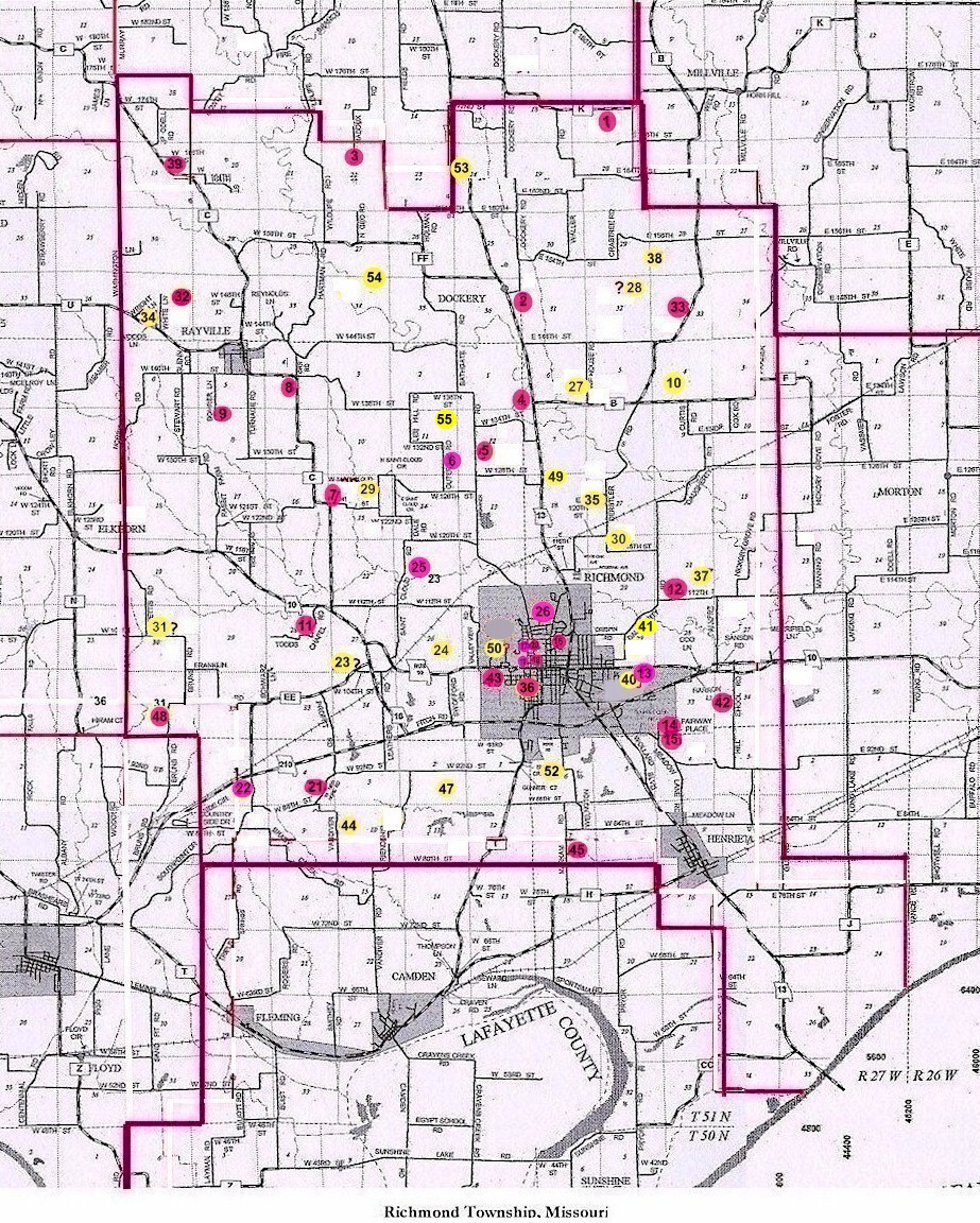
#22 on RichmondTownship Map |
 |
||
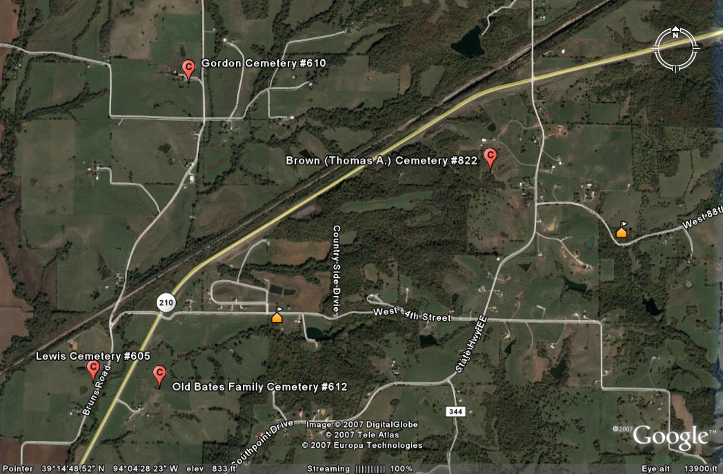
| Thomas A. Brown Cemetery | #22 on Richmond Township Map | Latitude: 39°15'1.18"N Longitude: 94° 3'55.72"W |
From 210 Hwy, turn south onto EE Hwy. Travel about 4/10 miles to driveway on west side of road. [Cemetery is on private property so please be sure to ask permission to travel through the field.] Turn into the driveway and proceed to the gate. Walk or drive about 2/10 miles through a pasture with very rough terrain. The day I visited the cemetery, the path through the pasture had not been mowed and it was heavily washed out from prior rains. Cemetery is fenced but was not mowed. 1973 History: cemetery shown in Orrick Twp as #6 on Ray County History 1973 cemetery map p. 230 DAR Index: Cemetery located in Richmond Twp on Hwy EE Located 6 miles west of Richmond, Missouri off EE Highway Road which joins Highway 10 and 210. It is on land known as the Thomas A. Brown farm. (1973) The Brown Cemetery lies west of the road, about a quarter mile from the land homesteaded by Thomas Brokenberry Brown, father of Thomas A. Brown." New Hope Cemetery is about a mile east of the Brown Cemetery This cemetery was started by Thomas Ashley Brown as a burial ground for his family and their descendants. Each family had a plot, and no charges were made for the grave plots. the cemetery is now incorporated under the County Court and is administered bay a Cemetery Board. Donations have been invested and the interest on this fund provides for the upkeep. Family tradition says that Martha, the "blue baby" was the first burial. Daughter of Thomas a. and Martha "Patsy" Brown, she lived with her affliction for something like a year, longer than most "blue babies" of that day. For this reason, the doctor wanted to do an autopsy. Her father would have none of it. Instead, he took her wee body and buried it in a wheat field, and visited the grave every morning for a long time to see that on one had disturbed her grave. While this would not be proper procedure today, her tiny grave stands here as mute testimony to a father's love for his afflicted baby girl. Four other children died in childhood, and three daughters died in their twenties, and the cemetery grew around these early burials. Five sons and two daughters lived to rear families. Except for William T., these children, their spouses, and some of their children are buried in this cemetery. William T. and some of his children, as well as Thomas A's parents, are buried in the New Hope Cemetery, about a mile east of the Brown Cemetery. The cemetery located off the road, is about six miles west of Richmond, Missouri. It lies west of the road, perhaps a quarter mile from the land homesteaded by Thomas Brookshire Brown, father of Thomas A. Brown. A roadway has been graveled, and it is possible to drive there, going through two gates. A few burials have been made in recent years, and perhaps a few more are contemplated. The location, when one gets there, is beautiful. A few trees have been planted and the view from here covers many miles, toward Richmond. There is plenty of space for more graves. The ground, itself, is well-kept. As with other cemeteries of the era, there are many graves of children and young mothers. |
Recorded in 1973 by Pauline Brown | Ray REF 929.3 RAY
Lookups by Joan Graham Atkinson |
Transcription:
Ray County Home Page | MoGenWeb | USGenWeb | WorldGenWeb | E-Mail County Coordinator
To add additional information relating to Ray County, Missouri Genealogy, E-Mail the county coordinator.
since November 11, 2006
Last Updated