|
 |
|
|
|
|
#609
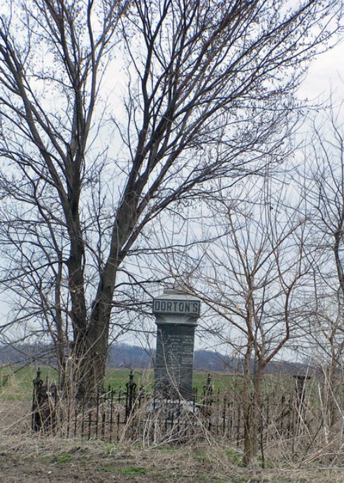
Dorton Cemetery Orrick Township |
||
Ray County Cemeteries - Web Page
|
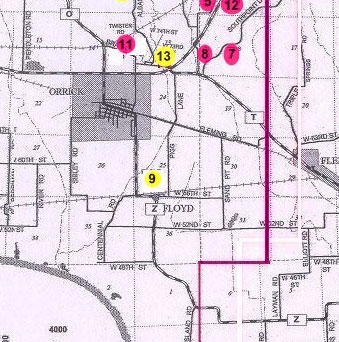
#9 on Orrick Township Map |
 |
||
| Dorton Cemetery |
#9 on Orrick Township Map |
Latitude: Longitude: |
shown as #9 on Ray County History 1973 cemetery map p. 230
Ray County Library (big black cemetery binder): Located T51R28S25 [I believe this should be R29, based on the directions]; farm formerly owen by John Dorton, now belonging to ________ Crow [1978], about 1 mile south of Orrick toward Floyd on Route Z There is one large family stone with the dates around the planes of it. Stone was erected in 1903. One other stone still remaining besides the large stone--that of Sarah B., wife of J. B. Dorton, died Jan 16, 1883, aged 73 yrs, 10n mos, 13 das. Jenna: I don't know who is actually buried there and who isn't, other than Sarah B. Dorton because her original stone is out there. |
Ray REF 929.3 RAY |
|
 |
Transcription:
Ray County Home Page | MoGenWeb | USGenWeb | WorldGenWeb | E-Mail County Coordinator
To add additional information relating to Ray County, Missouri Genealogy, E-Mail the county coordinator.
since November 11, 2006
Last Updated