|
 |
|
|
|
|
#612
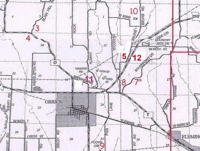
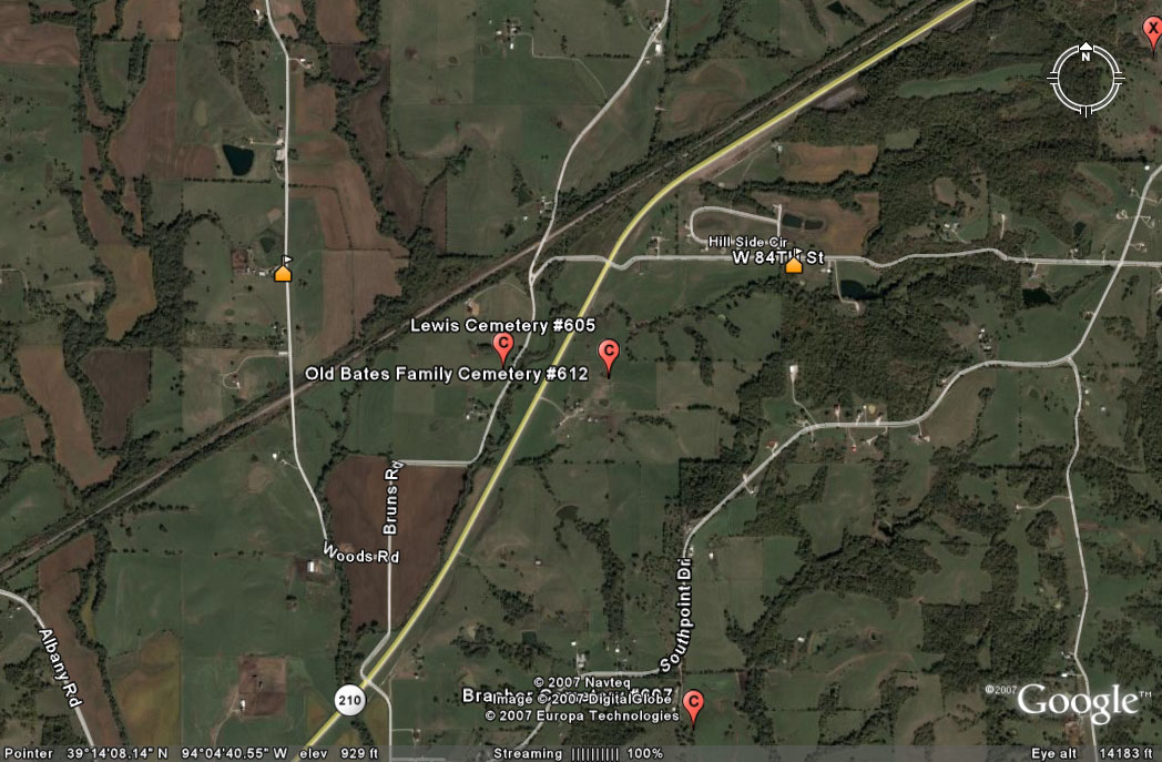
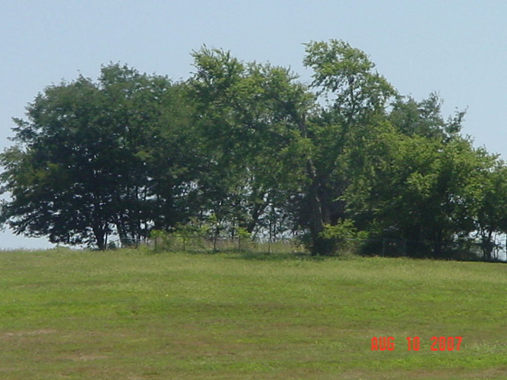
Bates Family Cemetery Orrick Township |
||
Ray County Cemeteries - Web Page
|
#12 on Orrick Township Map |
 |
||
| Old Bates Family Cemetery |
#12 on Orrick Township Map |
Latitude: 39°14'17.98"N Longitude: |
Source: Ray County Library, Richmond, Mo (big black cemetery binders): Take 210 Camden to Orrick. Turn left at the next north turn after the EE turnoff, alongside South Point Cemetery. Proceed to Lewis Cemetery, west side of road. Across the road, on east side will be the Isenhour mailbox. Cross bridge, which may be locked. Proceed until north and a little east of residence. There is one evergreen tree and another tree. The cemetery is fenced with a little gate. Only four stones are identifiable. Hwy 210 has changed since this description was written. The address is: 35857 Highway 210, Orrick Missouri. The driveway is east of Hwy 210. |
RAY REF 929.3 Ray |
|
photo submitted by Jennifer Zunker |
 |
Transcription:
Ray County Home Page | MoGenWeb | USGenWeb | WorldGenWeb | E-Mail County Coordinator
To add additional information relating to Ray County, Missouri Genealogy, E-Mail the county coordinator.
since November 11, 2006
Last Updated