|
 |
|
|
|
|
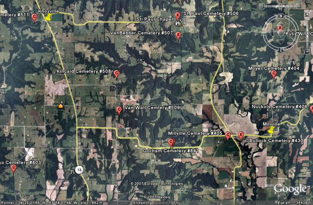
#509
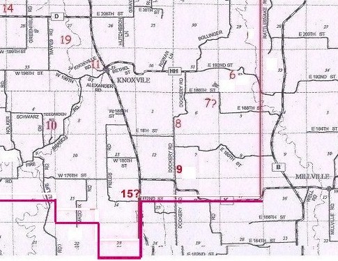
Van Wall Cemetery Knoxville Township |
||
Ray County Cemeteries - Web Page
|
#9 on Knoxville Township Map |
|
 |
||
|
Van Wall Cemetery (aka Clark-Crammer) (aka Cramer-Smith) |
Latitude: 39°24'44.00"N Longitude: |
#9 on Knoxville Township Map #9 on Ray County History 1973 map, p. 230 Knoxville Township (Cramer or Smith Cemetery) typed sheet in big black Cemetery binder at Ray County Library (Clark-Crammer Cemetery): located highway 13, turn east on Millville Road [Hwy K] eight tenths of a mile; turn north to first lane east, about 1/4 mile northeast, Cemetery is well fenced DAR Index: Clark/Cramer Cemetery - Located in Knoxville Twp. Take Dockery Road 1/10 mile north of Route K. Cemetery is on east side of road, 100 yards in field. cemetery marked on 1914 Plat Book on Van Wall property (Section 7) Lisa: Van Wall's death certificate states he was buried in Van Wall Cem. However, everyone else for the Cramer/Crammer Cemetery states that they are buried in Cramer/Crammer Cemetery. |
. | Ray REF 929.3 RAY |
Transcription:
Ray County Home Page | MoGenWeb | USGenWeb | WorldGenWeb | E-Mail County Coordinator
To add additional information relating to Ray County, Missouri Genealogy, E-Mail the county coordinator.
since November 11, 2006
Last Updated