|
 |
|
|
|
|
#420
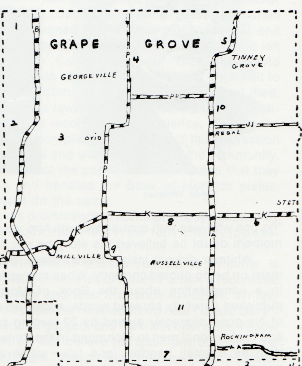
Petree Cemetery Grape Grove Township |
||
Ray County Cemeteries - Web Page
|
|
#2 on 1973 Ray County History |
 |
||
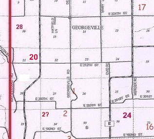
| Petree Cemetery | #20 on Grape Grove Township Map | Latitude: 39°28'1.00"N Longitude: estimated |
#2 on 1973 Ray County History map p. 230 Ancestry.com: Located east of Taitsville, Missouri on Dr. Bower's Farm DAR Index: located west of Hwy B 8/10 miles on E. 212th Street. Cemetery is 1/2 mile north in field [that's north of 212th, p. 230 in 1973 History looks as if it is south] 2005 Plat Book Section 21 |
compiled by Elizabeth Prather Ellsberry, Juliette L. Smith and Mrs. Carlton Richardson
Copied by Mrs. Carlton Richardson, Rayville, Mo. v. 2. Cummins, Holder, Kincaid, Knoxville, Linville, McVeigh, Petree, Petty, Rainwater, Sandals [Thomson], Sylar, Teegarden, Van Bebber, Yoakum cemeteries
|
FHL 977.819 V3e v. 1-2 |
Transcription:
Ray County Home Page | MoGenWeb | USGenWeb | WorldGenWeb | E-Mail County Coordinator
To add additional information relating to Ray County, Missouri Genealogy, E-Mail the county coordinator.
since November 11, 2006
Last Updated