|
 |
|
|
|
|
#427
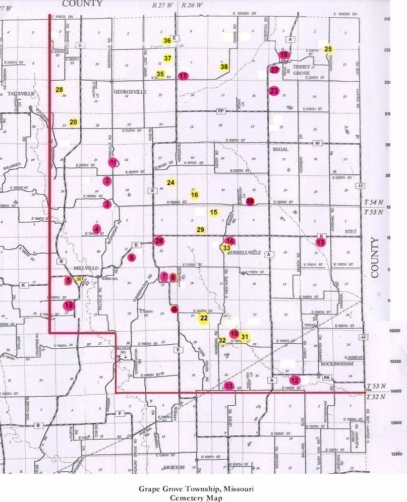
Elder Cemetery Grape Grove Township |
||
Ray County Cemeteries - Web Page
|
#27 on Grape Grove Township Map |
 |
||
| Elder Cemetery |
#27 on Grape Grove Township Map |
Latitude: 39°30'2.02"N Longitude: |
West of Tinney Grove on "A" Highway. There is a large field with horses on the curve. Locate the gate that is about 1/4 mile east of the curve. Walk down the outside of the electric fence on the east side. The cemetery is located about 350 yards from the road.
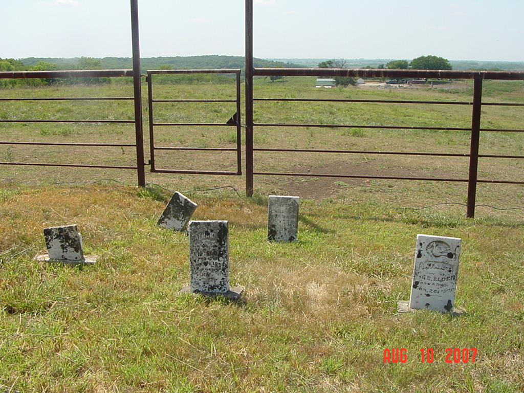
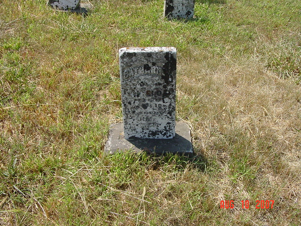
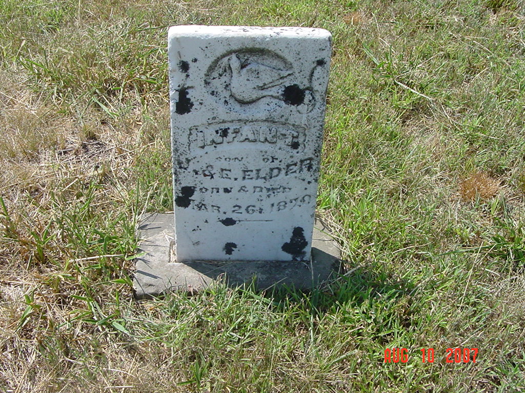
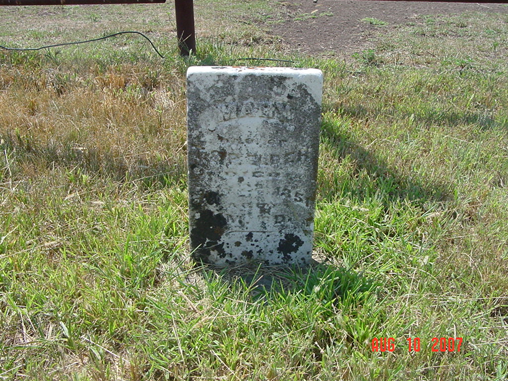
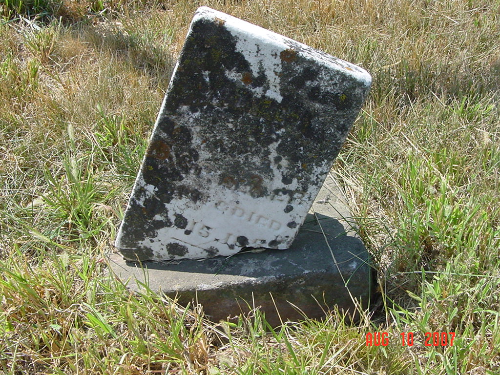
There is a large stone with several bars around it. There are about 5 gravestones. The owner has mowed and maintained the area. Shawn Coats property. The man that showed me this cemetery says that Elder's are buried here and another brother was buried over in Carroll County. He thinks there are slaves buried near these stones, but no one knows for sure. |
Genealogy Trails Transcription online |
 |
 |
 |
 |
 |
|
Transcription:
Ray County Home Page | MoGenWeb | USGenWeb | WorldGenWeb | E-Mail County Coordinator
To add additional information relating to Ray County, Missouri Genealogy, E-Mail the county coordinator.
since November 11, 2006
Last Updated