|
 |
|
|
|
|
#105
McGinnis Cemetery Camden Township |
||
Ray County Cemeteries - Web Page
|
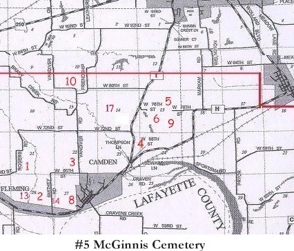
#5 on Camden Township Map |
 |
||
| McGinnis Cemetery
(aka Prichard Cemetery) |
#5 on Camden Township Map #5 on Ray County History 1973 cemetery map p. 230 Camden County |
Latitude: 39°13'41.00"N Longitude: estimated DAR Index: T51R28S13 |
Ray County Library (big black cemetery binder): This cemetery was located (at the time of the transcription) on the Homer Douglas farm south of Richmond on Highway 210 [old 210] and on the east side of the road about 1/2 mile back from the road. There is also a slave cemetery just on the east side of the fence just east and next to the McGinnis Cemetery. | Ray REF 929.3 RAY |
Transcription:
Ray County Home Page | MoGenWeb | USGenWeb | WorldGenWeb | E-Mail County Coordinator
To add additional information relating to Ray County, Missouri Genealogy, E-Mail the county coordinator.
since November 11, 2006
Last Updated