 |
 |
|
|
|
|
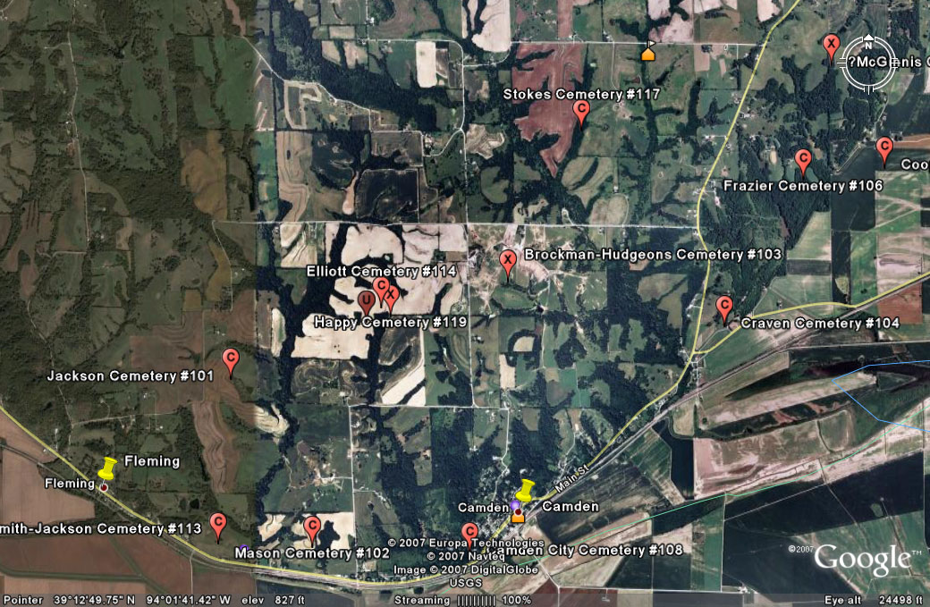
#114
Elliott Cemetery Camden Township |
||
Ray County Cemeteries - Web Page
|
#14 on Camden Township Map |
 |
||
| Elliott Cemetery
(close to Happy Cemetery) |
#14 on Camden Township Map |
Latitude: 39°11'35.00"N Longitude: estimated T51R28S21?| |
Located in a field of 7040 Vandiver Road (Jennifer) Elliott Cemetery: according to Ray County History 1973, p. 232 Cemeteries Not Listed on Map, #20; south and west of Richmond, on Robert Vandiver farm. Happy Cemetery: according to Ray County History 1973, p. 232 Cemeteries Not Listed on Map, #22; north of Fleming [see Happy Cemetery] Ray County Library (big black cemetery binder): has a separate sheet for Happy Cemetery (aka Norris Cemetery) and Elliott Cemetery; says Happy Cemetery is close to Elliott Cemetery Both Happy Cemetery and Eliott Cemetery are fenced with a wooded area between them. The Cemetery is a few blocks off of Smithey Road, not very far from a Vandiver house. A Mr. Smithy said a daughter of Vandiver still lives in the house. The cemetery is in the middle of a dirt field. It is probably on private land. It is a shame that it a so neglected. Mr. Smithy also said that part of the cemetery may have been called Happy Cemetery. My family married into the Conrad family. These are a few pictures of my family's headstones. Jerry Farris jfarris@kc.rr.com |
Ray REF 929.3 RAY |
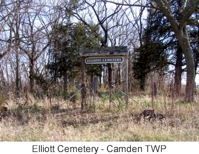
photo submitted by Jennifer Zunker |
||
Transcription:
Ray County Home Page | MoGenWeb | USGenWeb | WorldGenWeb | E-Mail County Coordinator
To add additional information relating to Ray County, Missouri Genealogy, E-Mail the county coordinator.
since November 11, 2006
Last Updated
